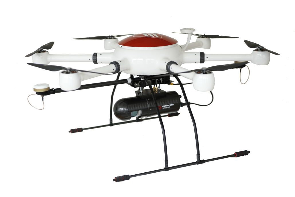
Introducing ConVecDro LIDAR drone package
The lidar solution
After weeks of integrating and testing the system in many different applications, countries and scenarios, we are very pleased to introduce the ConVecDro LIDAR package. Built around our amazing ConVecDro drone platform and Routescene’s amazing LidarPod, this lidar drone solution allows land surveyors a wide range of mapping applications. With a net flight time of >22 minutes with the lidar system attached, the system collects up to 700.000 points per second and can cover an area of up to 110 hectares in a single day (including setup times, battery charing, etc.)
Best in class flexibility
The flexible integration is completely detachable. This allows ConVecDro to be transported more easily and to transform from lidar drone configuration into a high-quality photogrammetry solution in less than three minutes. Making it the one stop shop for advanced mapping and surveying.
Systems start at just 17.500 €. Don’t hesitate to contact our sales team!


Leave a Reply
Want to join the discussion?Feel free to contribute!